Section II, Team II, REPORT Sheltowee Trace from Charit Creek Lodge to End of the Divide Rd, 30.5 miles (56.5 miles total YTD)
Every good adventure requires calamity, and this trip was no different. I recently bought a new battery. The shop had installed it, and the car was running fine. So, when I set out for my Big South Fork adventure on Friday evening I was dismayed when my car wouldn’t start. I’ve had a lot of work done on my car recently; a new timing belt, tune-up, new fuel pump, new battery etc., so I automatically assumed the worst. With a saddened heart it seemed as though my trip was finished before it began. After some worrying and waiting for family to arrive, I started tinkering with my car, and much to my surprise the shop I had bought the battery from had not tightened the cables onto the battery terminals. With a little tweaking I was able to get the car to start right up. Now looking back, it doesn’t sound like such a calamity, but at the time I thought my trip was canceled.
I made it into camp at Peter’s Mountain just before dusk; several hikers were already milling around a campfire, and tents were setup around the periphery of the parking area. My friends Daniel and Greg from Northern Kentucky were already set up for the night. Many of the Team Two members that I had met on section One started to roll in. This was the biggest group of hikers to hike with the STA all in one go. Because Team One’s trip was canceled the previous week, we were a combined strength of the two teams.
I set up my tent and joined the party. It was a nice, windy night. The trees on the mountain top were swaying heavily in the wind. The breeze was brisk, but the overall temperature was manageable.
I met several new hikers, and we shared a sense of history and the future. We had all been to a lot of the same places, with a universal passion for the Sheltowee Trace. What is striking is the wide-ranging backgrounds of all of the different hikers. At first you might believe that we are all granola; sworn enemies of the scourge of modern civilization. That assumption is mostly false. While that may be partially true for some of us, we are actually a very diverse group of people. I have met medical doctors, lawyers, plumbers, retired military, brewmasters, computer engineers, farmers, biologists, chemists, republicans, democrats, libertarians, liberals, professors, forklift operators, payroll clerks, police officers, bankers, and airline pilots. We come from all walks of life and backgrounds but share the same unique vision. We are all wanderers and explorers.
After climbing in my tent for the night, I took a brief snooze and was then awakened about 12am to find nature calling. Groggily I complained while climbing out of my tent. The wind had died down a little, but now a weird twilight was upon the land. Through a light layer of altostratus, the waxing gibbous moon illuminated the ground as bright as early morning. I didn’t need my headlamp and left it lying in my tent.
About 5:30 in the morning I woke up to the hustle and bustle of hikers decamping and preparing for their commute to the trailhead. We walked 18 miles on Saturday. Once at the trailhead, we took our obligatory group picture and then sped off in a massive herd of hikers. We made our way down into Charit Creek valley, climbing down a steep staircase, then briefly along a bluffline before descending a myriad of confusing switchbacks. A large group stopped to check out the lodge at the bottom of the hill and naturally dispersed. Greg, Daniel, and I stayed somewhere about mid-pack for most of the hike. Along the wide, soft rolling hills we quickly made good time on our way from Station Camp Creek to the historic settlement of No Business. Blasting by a large group of hikers stopped at Maude’s Crack for lunch, we continued at a good clip.
The newest section of the Sheltowee Trace in the Big South Fork follows the John Muir Trail (JMT). After a brief walk through No Business, we began our slow steep climb up to the John Muir Overlook. This was a serious hill. I believe someone in our group clocked the elevation change at over 500 feet (that’s taller than the Eifel Tower at King’s Island by nearly 200 feet). At the top we saw beautiful vistas only accessible by foot or mountain bike.
Winding along a long ridge line, we continued to follow the JMT into the passing of night. I began to recognize areas that I worked in during my time with the National Park Service. The weather had been extremely pleasant all day. Moderate cool temperatures and overcast skies made for exceptional hiking. After dark we donned our headlamps and continued to press forward the last four miles. The chill picked up a bit, and a light mist began to spray into the beams of our headlamps.
Hiking for me is a very spiritual time. It’s the closest thing to a physical manifestation of Heaven that I can imagine. Oftentimes I pray as I walk. Deep in introspection, I can explore the mysteries of the world, living inside my own head. Time slows down to a crawl. Days become weeks. Things that happened in the morning become far off and distant memories. Life slows down.
We were greeted at camp by the hiker organizer Steve. Most hikers were beaten and went to bed before we arrived. I stayed up for a little while and sat by the campfire.
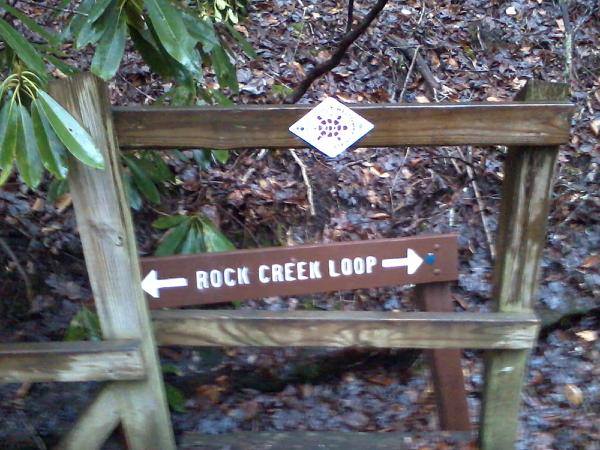
The following morning, we were met with a deluge of rain. Somehow my socks became wet before I even put them on. After a short breakfast on the trail, we descended into Rock Creek Valley. A beautiful series of cascading whitewater and waterfalls. Soon we were following along an old coal mine tram road. The remains of the old railroad spurs were now replaced in an even pattern of thick moss. We followed Rock Creek for several miles.
We were only doing 14 miles on Sunday (compared to 18 miles the day before), but this day was infinitely more difficult. Heavy rain had washed most of the trail out. The mud was thick, viscous, slippery, and grueling. A nicely graded gravel road across the creek taunted and mocked us as we made our way across the unforgiving hills. We were completely soaked the entire day.
We finally made our way to a clearing called Hemlock Grove where the trail took a ninety-degree turn up a long plodding drainage. This was my favorite part of the trip. The Big South Fork is actually a plateau. Most of the large creeks and rivers lie at the very bottoms of deep valleys and gorges called drainages. They are called as such because water from the top of the plateau drains down into the valleys. The last several miles of our hike climbed back up to Peter’s Mountain, following, crisscrossing, and sometimes following the middle of the creek. We walked many hundreds of feet through the middle of the creek. At the top of the gorge, we were rewarded with a beautiful waterfall, which rivaled the 113-foot-tall Yahoo Falls to the north (I haven’t looked at the maps yet to determine its name).
Muddy, bloody, tired, with blisters on our feet we finally crawled out of the gorge, still six miles to go on a gravel road. We made a valiant effort to finish the entire hike, but the trip leader finally called the hike before we could finish the last 1 1/2 mile. We completed 30.5 miles over the weekend. It was a good hike.